Wednesday thru Friday, July 25th – 27th
Glacier View (Grand View Café & RV Campground) to Soldotna
View Larger Map
We departed Glacier View and the Grand View Café at 9:10 am after a nice breakfast they offer and it was 47⁰ with partly cloudy skies. By the time we reached Eagle River and Anchorage there were clear skies and near 70⁰. Nice! We stopped in Eagle River at a car wash to clean the mud from the Denali Highway off and there was plenty of it.
For lunch we stopped at a turnout along the Turnagain Arm and arrived in Soldotna around 4 pm after traveling 251 miles. There was lots of traffic as fishing for Sockeye Salmon (reds) is on and it seemed like half of Anchorage were on their way to fish in the Kenai or nearby.
Matanuska Glacier
From the RV Park there was a trail to a bluff with a view of the Matanuska Glacier and the river. But it didn’t seem this large until the next morning when we traveled down the Glenn Highway and got a better view of it.
Turnagain Arm south of Anchorage
Our Campsite in Soldotna
We were very lucky to know someone who has a brother and sister-in-law in Soldotna. They not only allowed us to put our trailer on their place, they loaded our freezer with Sockeye filets and smoked salmon. They were very, very gracious and generous hosts. Their place is beautiful and the vegetable gardens both in and out of hothouses are terrific. They grow corn and melons along with many other things when everyone around them says you can’t grow corn or melons in Alaska!
View from the trailer
Our host’s home
This is how fishing for Sockeye Salmon is done
People fishing are usually nearly shoulder to shoulder. We must have been there on a slow day.
Fish landed
Soldotna to Homer, AK
Saturday, July 28th
View Larger Map
We departed at 9:30 am with warm clear skies, probably in the high 60s. Homer is only about 75 miles from Soldotna so we took our time and arrived at around 11 am. Again, we had beautiful weather all the way. There weren’t many turnouts that provided views of the Cook Inlet and the volcanoes on the other side. We did our best to get pictures but much of the land is private property.
Mt. Redoubt Volcano across the Cook Inlet
This one erupted a few years ago.
Mt. Iliamna Volcano across the Cook Inlet
This one hasn’t erupted but releases steam from time to time.
Arriving in Homer
Our Bay Crest RV Park site
View behind the trailer of Kachemak Bay. Sadie was happy to find some grass to roll on.
View of Homer Spit from our site
Overlook view of Homer Spit
Bumper to bumper and people everywhere on the spit
Tomorrow we will visit the Norman Lowell Gallery then The Islands & Oceans Visitor Center as I think they offer some tours. The Chamber of Commerce visitor center directed us to a number of other venues we might check out. We may go back down to the spit check out some of the shops.
I am not sure when we will be doing another blog post, hopefully soon. Our daughter required emergency surgery and as a result of complications delivered a premature baby. Both are fighting to recover their health. Linda will fly back to help her when she is released from the hospital as right now there are several family and friends helping. We will continue our trip for the next few days until we know when Mom is needed. Then I’ll get Linda to the nearest airport and Sadie and I will head south with a minimum of stops. Wi-Fi and time to do the blog will be in short supply or nonexistent most of the remainder of the way.
Maybe this will be a good reason to return to Alaska again.
Saturday, July 28, 2012
Tuesday, July 24, 2012
Denali – Paxson Lake – Glacier View, AK
Monday, July 23rd
Denali to Paxson Lake via the Denali Highway (Cantwell to Paxson)
View Larger Map
We planned on an early start but I slept later than planned and there was a wait at the dump station. Then we had to stop at the post office to mail some things to the special grandchildren. We finally got on the road at 9:50am. We traveled 176 miles with a stop for gas in Cantwell and multiple stops for pictures and one for lunch. We finally arrived at Paxson Lake around 4 pm. The temps were in the low 50s all day with scattered rain showers.
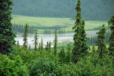
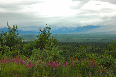
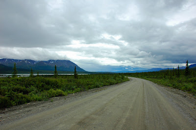
The first 3 miles of the Denali Highway were paved and then the next 10 were muddy as the road had been graded leaving loose dirt and gravel on the top. With the rain it turned to slippery mud. Beyond that it was rough in spots; washboard, potholes, etc., but for the most part not worse than the other gravel roads we traveled (Dempster & Top of the World). The unpaved portion is 110 miles and the scenery changed as we went east. There were scattered showers and low clouds so we couldn’t really see the mountain ranges on both sides of us. On a clear day this route would be fantastic. As it was it was worth the effort and the bumps.
View of the Nenana River
The truck and trailer after the first segment with the mud
Along the road:
View of the Susitna River
Wood decked Susitna River Bridge
Caributts
We came upon what we thought were people from a distance but was a herd of caribou cows and their young.
They stayed on the road looking back at us for quite awhile until a motorhome came from the other direction and they finally scattered in different directions off the road.
More sights along the road
Swan on small pond
McClaren Glacier
Tuesday, July 24th
Paxson Lake to Glacier View (via the Richardson and Glenn Highways)
View Larger Map
We departed at 8:15am and were 9 miles down the road before we returned to the campground to get the outdoor mat that I had left of the picnic table to dry out some. In all we traveled 158 miles (it should have been 140) and arrived at 12:30 pm. It was 46⁰ when we left and was in the mid 50s when we arrived. It was raining with low clouds most of the way but as we neared our destination the clouds began to lift some and we had some sunshine.
Nelchina Glacier along the Glenn Highway
Summit on the Glenn Highway
Note the poles that mark the snow depth and where the sides of the road are for the snowplows.
We stopped at Grand View Café and RV Campground. The mountains across the road are noted for viewing sheep. We are in an area surrounded by mountains and is beautiful, providing they are not covered by clouds. The little RV Park is mostly composed of gravel but the view makes up for it. The Café and staff have been great and the food is good. We would return to this little spot in the road
Sunday, July 22, 2012
Fairbanks to Denali and the Park
Friday, July 20th
View Larger Map
We departed Fairbanks at 9:45am and arrived at Riley Creek Campground in Denali at 12:30pm and traveled 121 miles. It was 51⁰ when we left and in the 60s when we arrived. Starting out it was overcast with a heavy layer of low clouds. About halfway to Denali the sun started to peak though and it wasn’t long before we were in the sunshine most of the time. It is still broken clouds and the campground host said it was supposed to be sunny tomorrow but didn’t think we’d see the mountain, at least the top.
The highway was very good until we were about 10-15 miles north of Healy. From there to the park entrance there were a lot of frost heaves, not bad but a lot of ups and downs. We just slowed down and took it easy.
View of the Nenana River
View approaching the Alaska Range
The Alaska Railroad tracks are across the Nenana River from the Parks Highway.
We took the train from Anchorage to Talkeetna, Denali, and then Fairbanks on our 2005 trip.
Entering Denali National Park & Preserve
Of course we have to include our campsite to give those that may follow us an idea of what they are like.
Linda making the most of the sun and campsite
Saturday, July 21st
We had booked a shuttle bus trip to Wonder Lake near the end of the road which is at Kantishna 7 miles further down the road. It is 86 miles to Wonder Lake and the round trip takes 11-12 hours. Ours was 11 1/2. We left at 5:00am and got back to our camp at 4:45 pm. The bus departed from the Wilderness Access Center at 5:15 am. Although these busses are green they are still school busses with bench seats but do have seat belts. That is a long, long time to be in a school bus. We had a rest stop about every hour and spent 30 minutes at three of the stops.
The up side is we did see a lot of wildlife. Some we didn’t get pictures of such as the Lynx but all in all a good day.
Wilderness Access Center departure point
View of Polychrome Pass area
I can just imagine how beautiful this would be on a sunny day.
Wolf
She moved in and out of the bushes along the road and caused a traffic jam. We watched her for about 10 minutes as we moved up several times to get better views.
Female Caribou heading for quieter ground
No this isn’t Mt. McKinley
It is the little peak on the left, Mt. McKinley is hidden in the clouds and is at least twice as tall as this one
Linda at Wonder Lake.
On perfect sunny and windless day you can catch the mirror image of Mt McKinley from the other end of the lake. Of course without the wind and rain the mosquitoes would certainly carry you off. We were told that the area is covered in low growing blueberries and that the male mosquitoes are the pollinators for them. I’m not sure if it’s a tall tail but I will take the drivers word for it now.
Linda even found quilts in the Eielson Visitor Center
A view from Eielson Visitor Center
At Toklat River rest stop they have antlers you can pose with.
I could lift the Caribou antlers but the Moose antlers are separated and it was all I could do to hold one up. I don’t think I’d care to be a Moose and carry them around.
Dall Sheep
Named for the man that discovered the species.
Caribou Bull
View from Teklanika River rest stop
You may recognize the picture from the beginning of our Blog which we took on our trip here in 2005.
Our shuttle(tour)bus
If it looks like a school bus, and rides like a school bus and is uncomfortable as a school bus, it is a school bus even if it is green.
Young bull Moose that we saw near the end of our trip
We saw another small bull and one that was a distance away.
We did see a number of Grizzly Bears but they were all a long distance away and were more like viewing blonde colored dots. Binoculars did the trick to see them and several were lying down with their cubs and sleeping. A few were moving around. I think the final count of bears was 9. I think we saw 12 very near the road when we were here in 2005.
One thing the driver told us as we neared Wonder Lake and we passed a number of Beaver Ponds is that there are no beavers in them now. He told us two of the previous winters there had been very little snow to cover and insulate the ponds and they froze solid killing all the beavers. It is hoped the area will eventually be repopulated.
The Park does not intervene by reintroducing any of the animals or trying to feed or save them in harsh conditions. This is a complete ecosystem and they allow it to do what it will do naturally. No interference at all.
Sunday, July 22nd
While I updated the Blog Linda went to the Dogs, the Sled Dog Demonstration that is. The rest of the time I just laid back and tried to recoup from the school bus, I mean tour bus.
The sled dog demonstration
It is a free presentation by Denali Park Employees. Sleds and dogs are used in the park in winter time to protect the environment. Snowmobiles are not allowed within the park. It was a short, but interesting demonstration. The dogs are Alaskan Huskies, specifically bred for duty in Denali. They are used in winter for transportation and rescue. This photo shows 5 dogs bridled up and pulling the sled.
This is Aurora, one of the “finishers”. Her place is right in front of the sled. Normally a dog placed in this position has difficulty “getting along” with the other dogs. The dogs in the front are chosen for that position because they are leaders.
This one was waiting his turn to pull the sled. They love to work and thrive on it.
We will move on tomorrow and plan to take the old Denali Highway from Cantwell to Paxson which is 135 miles and only 23 of it are paved. We hope the weather allows us to see the mountain ranges on each side of the road and the conditions aren’t too harsh. We will see!
We have seen more that our share of beautiful country, animals, towns and cities. We have met some nice people. We wonder if we could do another trip a great as this.
Subscribe to:
Comments (Atom)


