Sunday, August 19, 2012

Canada / Alaska Road Trip Wrap Up

June 18th thru August 8th, 2012

As we think back on the highlights of our trip there were many. Jasper National Park, AB, the highway from Ft. Nelson to the Yukon border for all the wildlife, Miles Canyon in Whitehorse, Dawson, Tombstone Territorial Park on the Dempster highway, Top of the World Highway, Old Denali highway, Homer, Kluane Lake, YT, and the Cassier highway were all special places. There were a lot of others but we had been there before and had done a number of things that we didn’t do this time.

Maligne Lake, Jasper, AB


Miles Canyon, Yukon River, Whitehorse, YT


Tombstone Territorial Park, YT


We didn’t make it to Valdez or Haines and Linda didn’t see the things I did on the return trip so we to need return for those (at least the Cassier highway). It is difficult to say if there were places we wouldn’t go back to, it depends on the weather and the time of year as well as just what we want to see or do. I wouldn’t have skipped any of the spots on our route as all are worth seeing.

The place that really impressed me was Tombstone Territorial Park on the Dempster highway. Its stark rugged beauty really was incredible. It would be spectacular in the fall (late August early September) when the colors change. Same goes for the Old Denali highway. We saw Denali in late August in 2005 and the colors were something to behold.

Denali Nat’l Park


Old Denali Highway


Along the Glenn Highway


Kluane Lake


Our planning, preparation and the equipment/spare parts, etc. we brought along did the job as we didn’t need any of it.

The Alaska Highway is not the Alcan Highway of old. For the most part the highways are modern and suited for most vehicles in good condition. There are frost heaves, potholes, and gravel stretches for construction but if you slow down it is fine. Your vehicle will get dirty but that depends on which routes you take. Don’t worry, it washes off!

It was a trip we will never forget! Of course, now we are thinking about where we will go next.

Finally, as most of you know, our trip was shortened due to our daughter's emergency surgery and unexpected arrival of a very precious, tiny grandson. Our daughter is healing well and our little guy, at 1 pound 14 ounces, with the help of many caring doctors, nurses and family, is a little fighter and stable at this time. We hope the long road ahead for him will not have too many twists and turns and that he will be able to join his parents at home some time in November.

Wednesday, August 8, 2012

Rochester, WA to Home


View Larger Map

Tuesday, August 7th

From Rochester, WA I drove to Weed, CA 466 miles, starting at 7:30 am and arriving at 6 pm. I was going to stop in Grants Pass, OR but when I got there it was only 2:30 and too early to stop. It was 91 when I reached Weed but with a nice breeze it was OK especially with hookups and air conditioning.

Mt. Shasta towers over Weed and it was completely free of clouds (a little hazy) and there is not much snow left on the top. Coming into California from Yreka on to Mt Shasta City the mountain is there to welcome you.

Wednesday, August 8th

Both Sadie and I were ready to be home so we got on the road at 8:05 and didn't look back. We were on track to be home by 1:15 to 1:30 but not more than 35-40 miles from home there was a head on accident on the two lane road and traffic came to a stop. After about a 1/2 hour and most ahead of me turning around I moved forward and was ask to turn around if I could as it would be closed for hours. There were driveways blocked by gates on each side of the road leading to fields. With someone in front and another watching the rear I managed to get the truck and trailer turned around by backing up, pulling forward about 5 or 6 times before I could complete the turn.

We drove 84-8500 miles and the only accident is 35-40 miles from home.

We arrived about 2 pm after traveling 286 miles. The first thing Sadie did was find her tennis ball and wanted to play ball! She is happy.

More to come after Linda gets home on Sunday and we regroup.

No pictures as I was focused on putting miles behind me.

Monday, August 6, 2012

Cache Creek, BC to Rochester, WA

Cache Creek, BC to Rochester, WA (12 miles south of Olympia)

Monday, August 6th


View Larger Map

Even though I made a nice breakfast of scrambled eggs and bacon (for me, not Sadie) and taking my time getting things ready to go we got on the road by 8:15 with the temperature down to 66⁰. It wasn’t a good start to the day as a few miles down the road I realized I didn’t have my cell phone. At the first chance to pull off the road I went back and searched the trailer to no avail. Next I went through all the maps and guide books in the truck and whew, it was in between the pages of one book.

With that behind me I was looking forward to crossing the border by noon if possible.

The terrain continued to be bare hills with sagebrush and nice fields of hay below them.


It wasn’t long before I knew I had spoken too soon in the last post. The Frazier River canyon was beginning before me.


They must grow apples or some other fruits as there were fruit stands all along the highway in the first part of the canyon.

The river is impressive in size


Further down the vegetation changes back to more what I had envisioned. In the upper portion of the river canyon the river was somewhat muddy then in some of the middle portion it became clear only to be muddy further down. Must be other rivers flowing in that changes the color.

The road is next to the river many places along the way with a lot of place to pull off but not with a trailer. When there was, I saw it too late or I had other cars or trucks behind me and couldn’t safely slow down quickly enough. It isn’t the scenery that I had imagined, kind of like someone telling you how great a movie is and you get your expectation up and then feel it is a dud. This certainly wasn’t a dud but I like the Wind River Canyon in Wyoming, Glenwood Canyon on the Colorado, and the Yakima River Canyon between Yakima and Ellensburg, WA as well or better. Now you have some other river canyons to see.


As I approached Hope, BC at the end of the canyon the vegetation changed to pines, fir, and maples, more like Oregon and Washington. The Mountains were all around me.


From Hope towards Vancouver on the Trans Canada Highway the traffic was heavy and there was smog in the air. Welcome back to civilization. For those of you that saw Lee Marvin in “Paint Your Wagon” it reminded me of the song he sang that said “they civilized east, they civilized west and before you knew it, it was too civilized even for snow”. Something like that anyway.

Crossing the border was not a pleasant breeze through. The signs as you approach indicates the wait to get through and it indicated 10 minutes. I told the Border Agent that I was glad I had made a restroom and gas stop before I approached. He asked how long it took me and when I replied 35 minutes he said, that’s not bad many times it take 2 hours to cross.

Seattle and Tacoma were the next challenges as the traffic was bumper to bumper and just inching along all the way around on I-405 and then on some around Tacoma. I started going through before 3 pm and it took me until 5 pm to reach the Outback RV Park in Rochester, WA and that is just about 60-70 miles. It was quite a culture shock for someone that two days earlier saw only a few cars in 100 miles. Maybe I’m going the wrong direction at least until winter.

Today we traveled 369 miles and it was 81⁰ when we arrived, much better than yesterday.

One of the blog followers is trying to guess where I will wind up each night. So far he has only gotten one night right. He only has one more chance to guess as I plan to be home Wednesday night.

When Linda gets home I think we will do a recap of the trip and our favorite spots, tours, etc. with some of our favorite pictures. She may be home next week for a while at least.

It is hard to imagine that I was in Anchorage on Monday night a week ago, it seems much longer than that.

Sunday, August 5, 2012

Telkwa to Cache Creek, BC

Telkwa to Cache Creek, BC

Sunday, August 5th


View Larger Map

After finishing yesterday’s post I remembered I wanted to mention the construction south of Dease Lake and I think it was even south of Kinaskan Lake. They were cutting a swath with heavy equipment wide enough for a 6 lane freeway. They were make cuts and fills that will straighten and widen the road appreciably and a few years from now when finished everything south of Dease lake will be great highway.

On to today.

We got on the road at 7:50 am with sunny skies and 51⁰ and by 10 am it was 79⁰ and continued to get hotter the further east then south we went. By the time we arrived at Cache Creek it was 99⁰ at 6 pm. We traveled 498 miles and that was more than I intended.

I had decided on a place that looked promising in one of the books we have at Lac La Hache, Fircrest Resort and RV Campground. I pulled into it and it is right on the lake with the boat docks just behind the office. Unfortunately or possibly fortunately their power was out and at that point it was 94⁰ so I decided to pass on it. To get turned around I had to drive through the RV sites and I’m glad I didn’t check in. They were very close together and the place was full except for two sites. People and kids were everywhere. As I drove out it I thought it was once a great place…. In the 50s maybe.

I had expected to see some great scenery as people had talked about the Frazier and Thompson Rivers. What I have seen so far isn’t anything out of the ordinary. It may be down another road or I haven’t come to it yet. We will see tomorrow.

Pictures of the Frazier River.


Most of the way the scenery was of hay fields and pastures that were in cleared forest areas and were quite nice to look at. I didn’t see many beef or dairy cattle but I’m sure that are somewhere around.

The forests have changed from predominately spruce with some poplar family of trees intermixed (aspen, birch, cottonwood, and poplar as well as some others I couldn’t identify). For most of the day it was more pines with some spruce mixed in with the poplar trees. When I neared Cache Creek I felt like I was driving along the backside of the Sierras. The north and east facing slopes had trees but the south and west facing slopes were sparsely treed but with sage brush covering much of it. This must be in the rain shadow of some mountains to the west.

Tomorrow I plan on being somewhere south of Seattle and possibly home on Wednesday night. Sadie is ready to get home and play ball!

It is 9 pm and it is dark outside....Great!

Saturday, August 4, 2012

Dease Lake to Telkwa, BC

Dease Lake to Telkwa, BC

Saturday, August 4th


View Larger Map

Telkwa is just south and east of Smithers and 220 west of Prince George, BC. We were on the road by 7:15 am but had to stop for gas as I didn’t do it before stopping last night. It was mostly cloudy and 48⁰ when we left and by the time we reached Smithers I was pealing off my jacket. We arrive around 3:30 pm,we traveled 384 miles and it was 79⁰ when we reached the RV Park.

Road south of Dease Lake


The road was much better south of Dease Lake as it had undergone seal coating and I’m sure before they did they evened it out. Still somewhat narrow and not much in the way of shoulders but without traffic I traveled at 55 and occasionally 60 mph. In the first 50 miles today I encountered two vehicles but that changed as the day wore on and people got on the road.

When I reached Kinaskan Provincial Park there was a marked improvement


Small dashes on the road in preparation for painting the actual of lines on the road.

Fully lined road


The road from Kinaskan to about Bob Quinn Lake had painted lines and was quite smooth.


The road was lined with wildflowers of all colors but fireweed along with daisies and the yellow flowers not identified were like a carpet. Much of today if felt like I was driving through a special park. I even saw another little Black Bear as it ducked into the bushes from the road.


Notice most of these photos were taken through the windshield as there is not shoulder to pull off on and as I said before, when there is there isn’t a shot.
All along the road are rivers, streams, ponds, marshes, and lakes.


There were many gorgeous stands of fireweed


I passed by Kinaskan Lake Campground and Meziadin Lake Campground which are two I would like to come back and spend a little time at. In between was Bell 2 RV Park which looked very nice.

Past Meziadin Junction the clouds started to clear and I could start to see the mountains I’m sure I had been traveling through.


They really stood out as I approached Kitwanga


I am at Fort Telkwa RV Riverside RV Park


The sites all back up to the river and it is pretty. Only problem is the highway is just up the hill from the sites and across the river is the railroad. Only two trains so far but it seem they have to blow the whistle about 5 long blasts and 3 or 4 short blasts. I’m sure the people in town are used to it by now but for anyone not used to trains nearby this would certainly get their attention.

Tomorrow Sadie and I will move on the somewhere south of Prince George. The Thompson and Frazier river canyons are down that stretch and so we will plan it to be able to see them before we are real tierd. Of course Sadie may sleep through the sights.

Reports from Linda continue to be positive so we will continue to hope all goes well. We appreciate all that have expressed their concern and for their prayers.

Friday, August 3, 2012

Whitehorse, YT to Dease Lake, BC

Whitehorse, YT to Dease Lake, BC

Friday, August 3rd


View Larger Map

Sadie and I got a good start today as we were on the road by 7:20 am. It was mostly cloudy and 46⁰ when we left and by 9 am or so it was raining lightly and continued to do so all the way to Dease Lake and it was 52⁰ when we arrived. We traveled 405 miles.

The Cassier Highway started out narrow and some ups and downs as the road followed the terrain for the most part. If the terrain dipped so did the road. They did do some cut and fills if the slope would be too steep. Also there are no shoulders on the road but it isn’t a problem if you keep your eyes on the road, I did. Once I got past Boya Lake the road widened out for much of the way but there will still some narrow sections, plenty wide but it appears narrow. There are no lines painted on the road so you are free to choose your best path. I encountered about 20 vehicles in 100 miles. Some parts were rough with travel limited to 40-45 mph and others smooth and I could travel 55-60 mph.

This highway is definitely worth driving as it is beautiful as you drive between the mountains and along clear streams, rivers, and lakes. Not like many of them in the Yukon and Alaska that carry glacial silt or mud.

Today was also a good wildlife day although no pictures. I saw one small Black Bear along the edge of the road eating grass then about 15-20 miles down the Alaska Highway I saw another big Black Bear. The first one I saw at the last minute and couldn’t stop and the second was surrounded by other vehicles. Oh well, you’ve seen one you’ve seen them all right?

Fire area


This fire was in 2010 and delayed people we know from going down the Cassier. They were held at Junction 37 (Hwy 37 and Alaska Hwy) until it was safe to be led through. It burned a very large area. The fire weed is everywhere intermixed with the burned trees.

Mountains along the road


If only the day had been clear.

Some other views along the Highway


I am at Dease Lake RV Park which is OK but the Wi-Fi is slow. No cell service and the OnStar doesn’t work here because no one provides cell service. I tried calling Linda on Google Call but the connection was to slow for either of us to understand the other. It will have to be email tonight.

The reports on our daughter and baby grandson are good, but there is a long way to go for him.

I haven’t figured out where I will stop tomorrow so I will just go down the road and see where I wind up.

Thursday, August 2, 2012

Homer, AK to Whitehorse, YT

Monday, July 30th to Friday, August 3rd


View Larger Map

After discussing their needs with our daughter and husband they felt it would be best if Linda arrived on August 5th so we booked a flight for her out of Whitehorse, YT to fly down. That all changed Monday morning as our daughter as well as the baby were having more problems, which was more than Linda could take. She didn’t want to leave but was a basket case and anxious to be with her.

We cancelled the Whitehorse flight and got her on a flight out of Anchorage Monday night.

Homer to Eagle River, AK (A-B)

Monday July, 30th


The last few days kind of run together but we got on the road just after 8am and got to Eagle River after stopping in Anchorage to get a travel bag for Linda to take on the plane. It was 236 miles with rain most of the way. It did clear up late in the afternoon and we were able to take some nice walks around the campground at Eagle River State Park.

Our Campsite


The Campground


Notice the nice separation between sites.

Her flight was at 1:30 am Tuesday morning and I needed some sleep so I could drive the next day so I took her to the Airport around 10 pm and got back and to bed by 11. She arrived and was with our daughter and saw her baby by Tuesday morning.

Eagle River to Tok, AK (B-C)

Tuesday, July 31st


I departed at 8:10 am and arrived in Tok at 2:30 pm driving 310 miles. It was in the high 40s when I left and in the low 60s when I arrived in Tok. I didn’t want to go further and not have cell service or Wi-Fi and I didn’t know how much further I could go as the roads had a lot of frost heaves and it was slow going.

The skies were partly cloudy so the drive up the Glenn Highway and past the Matanuska Glacier was great. I didn’t stop for many pictures as we had covered this route before.


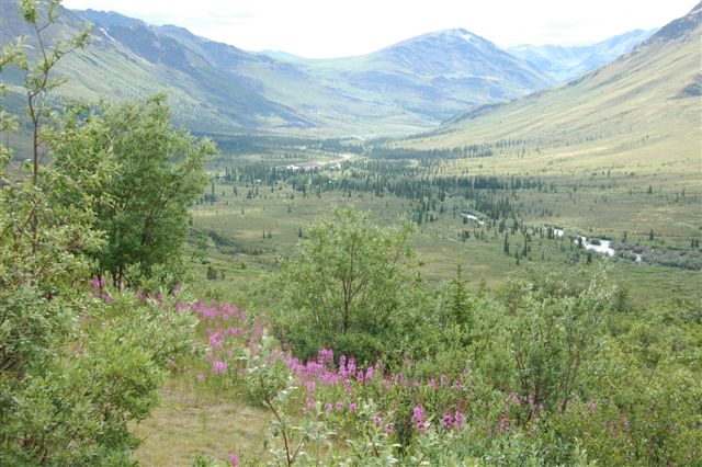
I couldn’t resist this shot of the fireweed which is everywhere with the mountains in the background along the Glenn Highway.

The last 20-30 miles of the Glenn Highway as you approach Glennallen had bad frost heaves and broken pavement. From there to about 50 miles up the Tok Cutoff were again bad making travel at 35-45 mph about the best I could do until it smoothed out some.

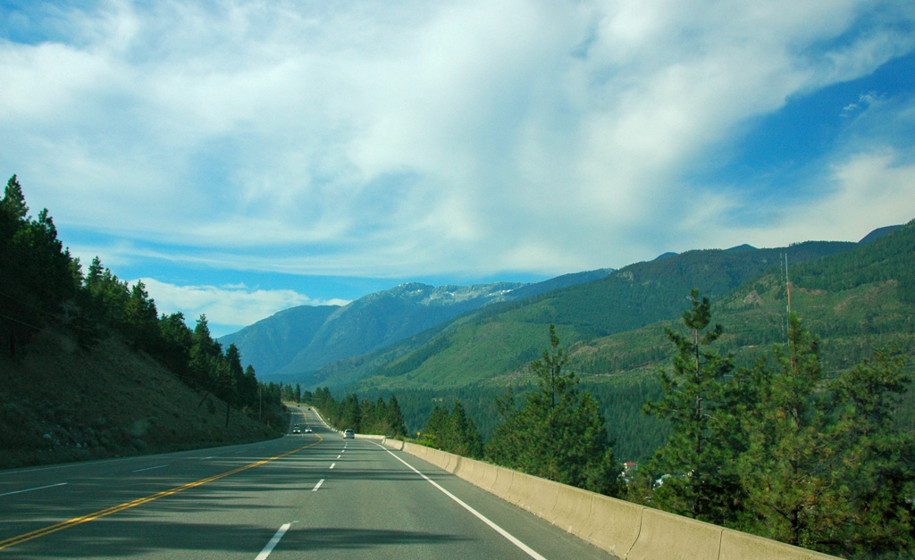
The Tok Cutoff road skirts the Wrangell St. Elias National Park and Preserve which was beautiful to drive by and see.


Tok, AK to Kluane Lake, YT (C-D)

Wednesday, August 1st


Again, I got on the road just after 8 am and arrived at Cottonwood RV Park on Kluane Lake, YT which was about 240 miles. Much of this section of the Alaska Highway (rejoined it at Tok) once you enter Canada is in rough shape, lots of construction, gravel stretches and frost heaves with broken pavement. Needless to say it was slow, again 35-45 mph much of the time. Just when you think it is smoothing out you hit another stretch. Just about everything in our closets were at the bottom by the time I stopped for the day.

This section of the Alaska Highway goes by the Tetlin National Wildlife Refuge and then the Kluane National Park and Preserve (Canada). Today it was driving in river valleys surrounded by mountains, some snow capped. Every time I saw something that would be a great picture there wasn’t a place to stop. When there were places indicating a photo shoot there were trees or bushes blocking most if not all the shot. I finally stopped along the road, put on the flashers and stood in the middle of the road to get the pictures I wanted.


Cottonwood RV Park is on the shores of Kluane Lake and when I say on the shores I mean it. The back of the trailer is about 20-30’ from the water. It was pretty windy when I arrived but it is calming down now.

We learned about this park when we were at the RV Show in Pomona. We were talking to the couple in the Trailer Life booth and she said they were the ones that rated the various Yukon campgrounds and RV parks. We asked about some and their favorites, Cottonwood was the top on their list. It only has 15 amp service as they generate their own power and hookups are electric and water or electric or none. The ones that back up to the lake are electric only. It is a beautiful park and we will stay here again when we come this way again. The people that own the park are very nice!!!


Kluane Lake to Whitehorse, YT (D-E)
Thursday, August 2nd

I over slept but still got on the road by 7:30 am. I wanted to get to Whitehorse so I could have the truck serviced and do some laundry. Yes, I can do laundry if absolutely necessary but Linda won’t let me do it at home as I don’t do it right (master plan). I got to Whitehorse at 10:45 am, washed the truck and trailer to get the construction mud off then dropped the trailer and went into town and had the truck serviced. It was 54⁰ when I left and 59⁰ when I arrived.

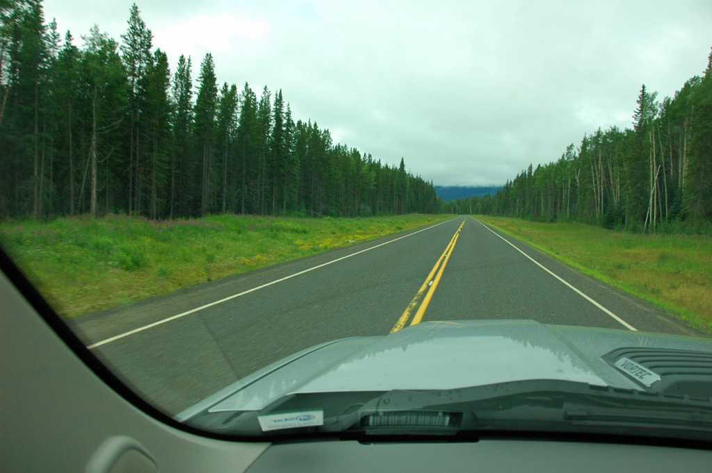
The road from Kluane Lake to Whitehorse was great with only a few frost heaves. I was able to do 90 most of the way (kph which is about 55 mph). I didn’t stop for pictures but needless to say this is a beautiful stretch especially the first part along and through the mountains.

I’m back at Hi Country RV Park the same one we stayed at when we were on our way up.

The news from Linda is good. Our daughter has been released from the hospital and now resting at home under the watchful care of her husband, mother and friends. She is definitely better and on the mend. Her baby is still in critical condition but stable and the doctors are positive. Our son-in-law’s aunt flew out from New York to help. She is an OB nurse and has spent most of her time with the baby, so I don’t think we could wish for anything more in the way of care, they are both getting the best.

I will start down the Cassier Highway tomorrow but haven’t determined where I will stop. I hope to find a place with Wi-Fi or at least a phone. I did discover that my OnStar phone in the truck works even though my AT&T cell service doesn’t. How long that will last I don’t know. All the way would be nice.

I will continue to post whenever I can pictures or not.